OMAHA, Neb.—A major ice storm created treacherous driving conditions across Iowa and eastern Nebraska this weekend and prompted temporary closures of Interstate 80 after numerous cars and trucks slid off the road.
Many events were canceled across the region when the storm hit Friday evening and businesses announced plans to open late Saturday as officials urged people to stay home if possible. However, temperatures are expected to rise high enough Saturday afternoon to melt the ice in most places.
“Luckily some warmer air is moving in behind this to make it temporary,” said National Weather Service meteorologist Dave Cousins, who works in the Davenport, Iowa office.
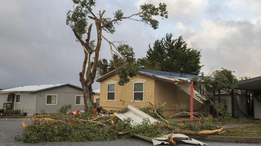
Elsewhere, a storm prompted the first tornado warning in San Francisco and caused some damage. And in the Northeast, people are digging out after heavy snow fell in upstate New York.
Some trees were toppled and roofs were damaged in the city that hasn’t seen a tornado since 2005, according to the Weather Service. The damage on the northwest side of the city was being assessed Saturday to determine if there was a tornado.
“This was the first ever warning for possible tornado in San Francisco. I would guess there wasn’t a clear signature on radar for a warning in 2005,” said Roger Gass, a meteorologist in the Weather Service’s Monterey, California, office who says he was not there in 2005.
The fast-moving storm prompted warnings for residents to take shelter, but few people have basements in the area. Meteorologist Dalton Behringer said “the biggest thing that we tell people in the city is to put as many walls between you and the outside as possible.”
More than 33 inches (84 centimeters) of snow was reported near Orchard Park, New York, but people who live there are used to dealing with heavy lake-effect snow this time of year.
By Josh Funk

