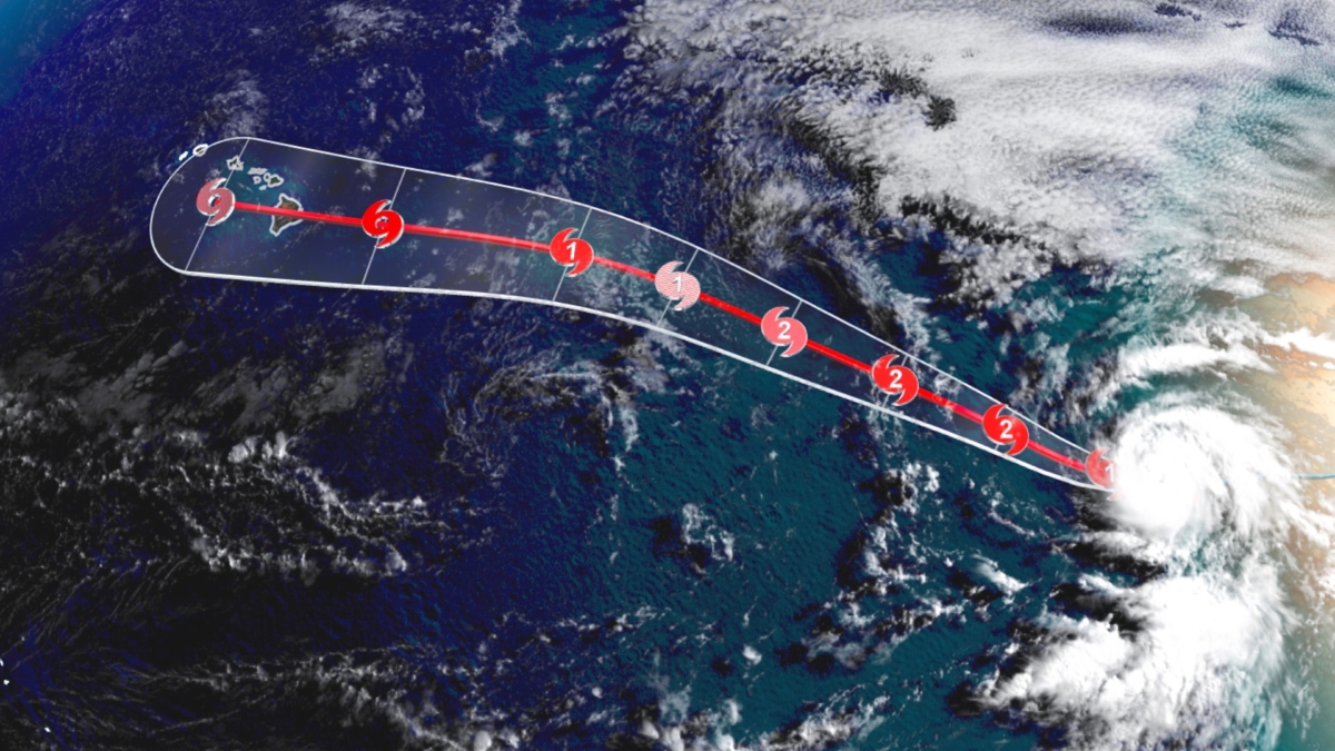
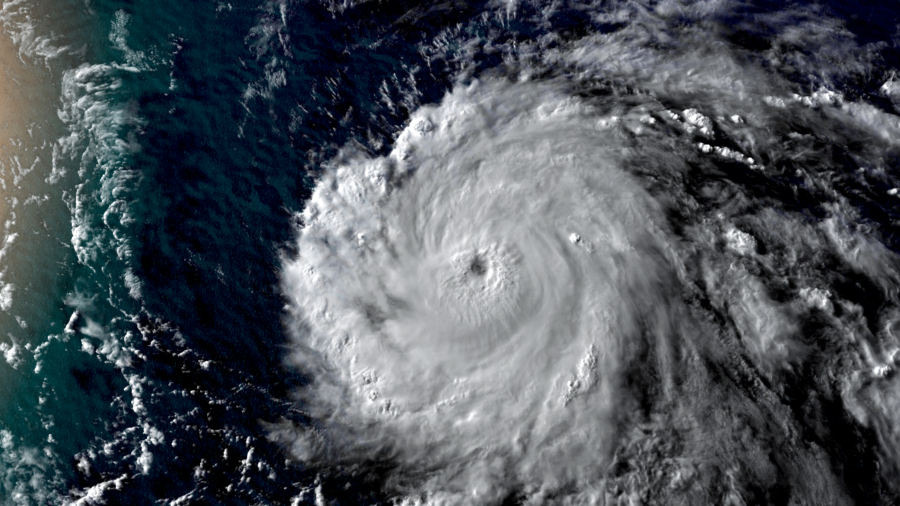
Douglas has rapidly intensified into a Category 3 hurricane on Thursday with wind speeds of 120 mph.
“The Hawaiian Islands should monitor the progress of Douglas,” the National Hurricane Center (NHC) said.
The storm is over 1,000 miles east-southeast of Hilo, Hawaii, but is moving west-northwest toward the island chain.
The forecast track from the NHC has the storm approaching the islands on Sunday.
The storm is forecast to continue to strengthen today but expected to start weakening by Friday.
“Douglas is expected to be at or near hurricane intensity as it approaches the Hawaiian Islands on Sunday,” the NHC says.

Rare for Strong Hurricanes to Reach Hawaii
“It is fairly common for hurricanes to track towards Hawaii, but they usually dissipate or at least weaken considerably before impacting the islands,” said Phil Klotzbach, a research scientist at Colorado State University. “For example, both Lane and Olivia impacted Hawaii in 2018. Also, in 2016, both Lester and Madeline threatened Hawaii.”
Although a hurricane’s effects on Hawaii can be severe, it is rare for major hurricanes to reach the shores of the island chain. For one, the Hawaiian Islands are a small plot of land amongst the largest ocean basin in the world making the statistical probability of a direct landfall very low.
Hawaii covers 6,423 square miles of land divided up among six main islands, making the chance of a direct landfall even less likely. Florida, by comparison, is a significantly easier target for hurricanes to strike as it covers more than 50,000 square miles
Douglas is expected to bring wind, rain and dangerous surf to Hawaii by the weekend, although it may be downgraded to a tropical storm by the time it reaches the islands.
There are other key weather features, like wind shear and dry air, that meteorologists look for to either steer storms away from Hawaii or weaken them dramatically before they reach the white sandy beaches of Honolulu.
One of the more influential atmospheric processes is a semi-permanent north Pacific high pressure system which often forces a detour of oncoming tropical systems. However, when that high pressure is weaker than normal or is broken down by an incoming trough, trouble can brew.
Slow Start to the East Pacific Hurricane Season
In a season that has seen early storm formation in the Atlantic, the eastern Pacific has been slower for storm development than in previous years.
“Douglas has been upgraded to a 65-kt hurricane, the first of the 2020 eastern Pacific season,” according to the hurricane center. “During the period of reliable records, this is the 4th latest date in which the first hurricane of the season has formed.”
A slow Pacific hurricane season, especially when paired with an active Atlantic hurricane season, is a sign of a La Niña event, which forecasters have predicted could occur this year.
Under La Niña, global convection wind currents yield sinking air over the eastern Pacific, and rising air over the western Atlantic. Sinking air patterns increase wind shear, a sudden shift in wind direction, speed or both, which can rip apart hurricanes before they have a chance to grow.

