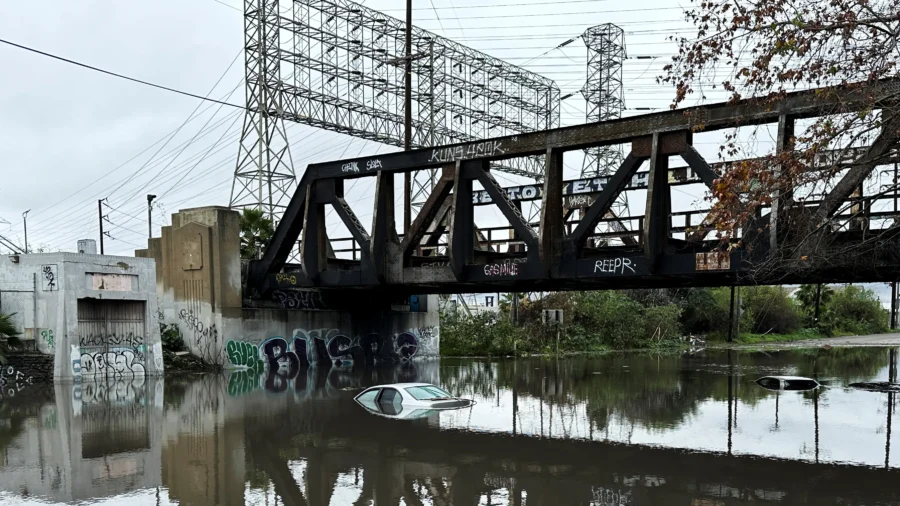
LOS ANGELES—A second, more powerful atmospheric river storm was headed for Southern California this weekend, threatening to unleash life-threatening floods and landslides, forecasters warned on Friday, even as much of the state was drying out from an earlier deluge.
Gradually intensifying rain was expected to begin dousing California on Saturday, with the most intense downpours soaking a 300-mile (480-km) stretch of coast on Sunday and Monday as the storm spreads from San Luis Obispo and Santa Barbara south through Los Angeles and San Diego counties.
The National Weather Service (NWS) posted flash-flood watches for the entire region in anticipation of staggering amounts of precipitation likely to fall over a 36-hour period, accompanied by strong gusty winds.
Rainfall averaging 3–6 inches (7–15 cm) was forecast for most of the region’s coastal and valley areas through Monday, with 6–12 inches expected in the foothills and lower-elevation mountains.
With soil already saturated and streams running high from the storm that drenched the region on Thursday, the flood potential from the coming onslaught is even higher than it would be otherwise, forecasters said.
“People need to start preparing now for a major flooding event,” the weather service said in a forecast discussion posted online.
The NWS said there was a good chance of rainfall totals as high as 15 inches (38 cm) in mountainous parts of Santa Barbara and Ventura counties, where the storm would probably hit hardest.
Communities on the south-facing slopes of mountains and foothills are expected to receive the heaviest downpours, leaving them most vulnerable to potential flash floods, mud flows, and landslides. Hillsides and canyons scarred by recent wildfires are particularly prone to washouts.
Widespread Risks
Flood hazards from the impending storm abound, the weather service said in its notice on Friday, warning in upper-case letters: “All areas, including highly populated urban areas, will be at risk for life-threatening flooding.”
In Los Angeles, the height of the encroaching storm is expected to coincide with the music industry’s Grammy Awards show on Sunday, prompting organizers to set up large tents for the pre-ceremony red carpet procession of the stars.
Elsewhere, crews were busy filling and stacking sandbags and clearing storm drains and culverts.
Flash-flood watches were also in effect along a relatively narrow stretch of California’s Central Coast, including Big Sur, extending north into the San Francisco Bay area.
High winds in those areas may prove to be a bigger factor than rain, said Daniel Swain, a meteorologist and climate scientist at the University of California, Los Angeles. Southern California remains the focal point of flood risks, he added.
Ski areas, on the other hand, were looking forward to a bonanza, as snowfalls measuring 2–4 feet (60-120 cm) are expected in the higher-elevation mountains, the NWS said.
Frozen precipitation from the storm will also benefit the region’s snowpack, helping to rebuild a key source of freshwater that has lagged below normal despite last year’s record-breaking winter storms.
Much of the region on Friday was still cleaning up from heavy rains that swept northern and southern portions of the state on Wednesday and Thursday, triggering scattered street flooding, rock slides, and mud flows.
Both storms formed from vast airborne currents of dense moisture called atmospheric rivers. They also fit the definition of a storm system known as a “Pineapple Express,” drawing on especially warm, subtropical waters around the Hawaiian islands.
About a dozen atmospheric river storms lashed California in rapid succession last winter, causing mass evacuations, power outages, levee breaches, and road closures in a state long preoccupied with drought and wildfires. At least 20 people perished in those storms, which nevertheless helped break the grip of a years-long drought in California.
By Steve Gorman

