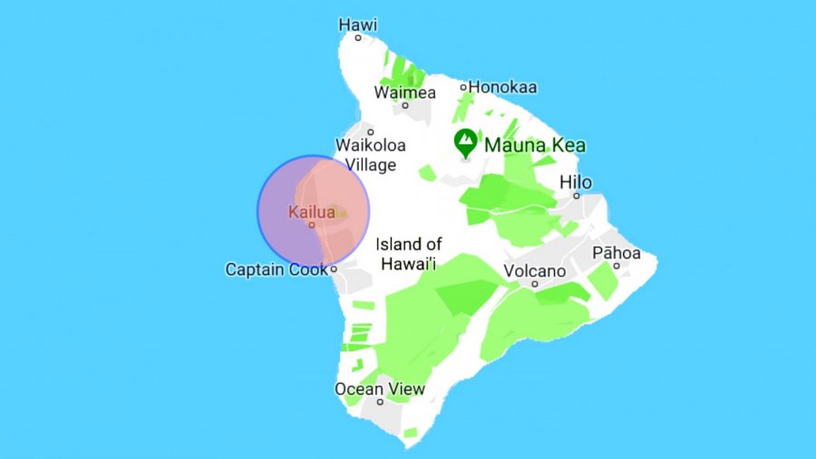
KAILUA-KONA, Hawaii—A magnitude 5.3 earthquake hit the west side of the Big Island of Hawaii on Saturday, the U.S. Geological Survey said.
The quake hit about 5 p.m. and had an epicenter about 15 miles southwest of Kailua-Kona, a city of nearly 12,000 people on the island’s west coast, the agency said. The earthquake had a depth of about 10 miles.
There is no danger of a tsunami, the Pacific Tsunami Warning Center of the National Weather Service said.
5.5 magnitude earthquake in the Big Island. NO tsunami threat.
— Hawaii EMA (@Hawaii_EMA) April 14, 2019
Map of felt reports received so far following the #earthquake M5.1 in Island of Hawaii, Hawaii 52 min ago pic.twitter.com/jkOIOu1Duj
— EMSC (@LastQuake) April 14, 2019
Parts of the island may have experienced strong shaking, the center said. The U.S. Geological Survey says it has received 894 responses from people saying they had felt the earthquake.
Did I just feel an #earthquake in #hawaii?
— Tyler Gore (@tcgore) April 14, 2019
Is the power out because of the quake? We were rocking and rolling in Kona! #Hawaii #Earthquake
— Julie Ziemelis (@JulieZiemelis) April 14, 2019
Hawaii Electric Light tweeted that about 3,300 customers were without power in the community of Waikoloa, Hawaii News Now reported. Crews were working to restore power.
520p: ~3300 customers without power in Paniolo Drive and Waimea side of Waikoloa area. 1st responder en route. Mahalo for your patience. #BigIslandOutage
— HawaiiElectricLight (@HIElectricLight) April 14, 2019
Civil Defense officials told Hawaii News Now that the earthquake caused a large boulder to come down on Highway 19-Queen Kaahumanu at the Hapuna Junction.

The news agency also reports that Captain Cook resident Elizabeth Cano said on Facebook that her whole house shook in the quake.
“I’m still cleaning up broken glass,” she said.
5.2 Earthquake on Western Flank of Hualalai on the Big Island.. #lethawaiihappen #gohawaii #Kilauea #Volcano
Posted by Hawaii Volcanoes National Park on Saturday, April 13, 2019
Quakes on East Coast?
While most of North America east of the Rocky Mountains has infrequent earthquakes, there are hotspots of intense quake activity.
Experts at the USGS say areas like the New Madrid seismic zone centered on southeastern Missouri, or the Charlevoix-Kamouraska seismic zone in New England, or the New York—Philadelphia—Wilmington urban corridor, are hotbeds of seismic activity. But they add that aside from these several areas, the region from the Rockies to the Atlantic can go years without an earthquake large enough to be felt.

The USGS points out that while earthquakes east of the Rockies are less common than in the West, they are typically felt over a much broader region.
“East of the Rockies, an earthquake can be felt over an area more than ten times larger than a similar magnitude earthquake on the west coast,” the USGS says.
“It would not be unusual for a magnitude 4.0 earthquake in eastern or central North America to be felt by a significant percentage of the population in many communities more than 60 miles from its source. A magnitude 5.5 earthquake in eastern or central North America might be felt by much of the population out to more than 300 miles from its source.”
Epoch Times reporter Jack Phillips contributed to the report.

