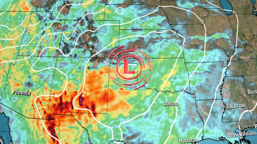
A powerful storm is poised to deliver nearly every weather hazard possible to the central US beginning Wednesday.
An extreme wildfire risk—the highest risk level possible—encompasses parts of Texas and Oklahoma, while feet of snow bury the Rockies and severe thunderstorms erupt in the Plains.
Here’s how each hazard is expected to unfold.
Wildfire Outbreak Possible in Epicenter of Devastating Fires
Gusty winds up to 50 mph will roar to life Wednesday afternoon across the southern Rockies and southern Plains as a potent storm takes shape.
These winds, in combination with warm, dry weather, and abundant dry grasses, and other plant fuel, have raised the fire weather risk to its most extreme level—Level 3 of 3—in parts of Texas and Oklahoma.
Fire weather conditions are at Level 2 of 3 Wednesday for a larger portion of Texas, Oklahoma, and parts of Kansas and New Mexico.
The area most at risk was devastated by fast-moving wildfires in late February and early March, including Texas’ largest fire on record, the Smokehouse Creek Fire.
“Dangerous fire weather conditions are likely and an outbreak of wildfires is possible,” the Storm Prediction Center said.
If a fire starts, the dry fuels will quickly go up in flames and allow it to burn rapidly through anything it can reach, supporting a “large fire spread,” the center said. The Smokehouse Creek Fire burned through over 1 million acres of Texas land in just a couple of days.
Winds are likely to fall just short of the ferocious 60 to 70 mph that drove that fire, but fires will still be able to spread quickly in similarly dry conditions.
“We continue to strongly urge everyone to do their part and help prevent wildfires,” the National Weather Service in Amarillo, Texas, urged Wednesday.
Officials urge residents to follow any burn bans in effect, avoid parking vehicles with hot engines on dry grass and to properly dispose of cigarettes.
The wildfire risk will drop considerably on Thursday as winds ease.
More Than a Month’s Worth of Snow for Denver
Around the same time the wildfire risk is peaking Wednesday afternoon in portions of the southern US, rain and a few thunderstorms will change over to snow in the Rockies and won’t stop until Friday.
Snow will fall from Wyoming to Arizona and New Mexico, but Colorado will be in the bull’s-eye.
Feet of snow are possible in the state’s highest elevations. Snowfall rates of 2 to 3 inches per hour are possible starting late Wednesday afternoon or evening, according to the National Weather Service in Denver.
But heavy snow will not be confined to mountain peaks.
Denver could record the most snow in three years as 8 to 16 inches are possible. Nearly 20 inches could pile up in the far western portion of the metro area, close to the Front Range foothills.
March is typically the snowiest month of the year for Denver, but this storm could bring more than an entire month’s worth of snow in just three days.
The heaviest snow for Denver is likely to fall from Wednesday night through Thursday when snowfall rates could reach 1 to 2 inches per hour at times. Travel is expected to become difficult within this window and could be nearly impossible in and near the foothills.
Snowfall will begin to ease late Thursday and slowly come to an end Friday across the Rockies.
Damaging Winds, Hail, and Tornadoes Possible
The same storm system and atmospheric energy that will bury Colorado in snow and elevate dangerous fire weather in Texas and Oklahoma will also ignite a round of severe thunderstorms Wednesday and Thursday.
Severe thunderstorms are forecast to rumble to life Wednesday afternoon in portions of the Plains and Mississippi Valley and track into the Midwest through Wednesday night.
The strongest storms will center over northeastern Kansas and western Missouri, including Kansas City, where a Level 3 of 5 risk for severe thunderstorms is in place, according to the Storm Prediction Center. A larger portion of Kansas and Missouri, as well as parts of Nebraska and Iowa, are under a Level 2 of 5 risk.
Large hail, damaging wind gusts, drenching rainfall, and even a few tornadoes are all possible within severe thunderstorms Wednesday and Wednesday night.
The greatest tornado threat will center on parts of Kansas and Missouri, including cities like Topeka, Kansas, and Kansas City, Missouri.
A few severe thunderstorms may also fire up in parts of Oklahoma and northeastern Texas late Wednesday afternoon, but the overall threat is more isolated than areas farther north.
Thursday will unleash a much more expansive severe threat from the southern Plains into the Great Lakes as the storm system pushes east.
An area stretching from Texas to Illinois and Indiana will be under a Level 2 of 5 risk for severe thunderstorms able to produce damaging wind gusts, hail, and a few tornadoes.
A higher Level 3 of 5 risk for severe thunderstorms will center on parts of Oklahoma, Arkansas, and Missouri. The risk for tornadoes will also be highest in this area.
The overall severe threat will ease on Friday, but isolated severe thunderstorms are possible along the Gulf Coast.
The-CNN-Wire
™ & © 2024 Cable News Network, Inc., a Warner Bros. Discovery Company. All rights reserved.

